Overview
My Monash final year project, with Shriabhay Shriharsha, written up as the paper Zone-First Container Localisation for Robot-Assisted Logistics on Commercial Space Station Environments.
Stowage work consumes roughly a quarter of an ISS astronaut’s working time, and the RFID inventory flown so far only locates items to within metres: enough to place an item in a module, not to pick it off a rack. We asked: can passive RFID zoning, refined by UWB and vision when needed, localise containers accurately enough for a crew member or robot to retrieve them without searching?
The method
Localisation runs in stages, each finer and more costly than the last, and starts from a record of where every container should be:
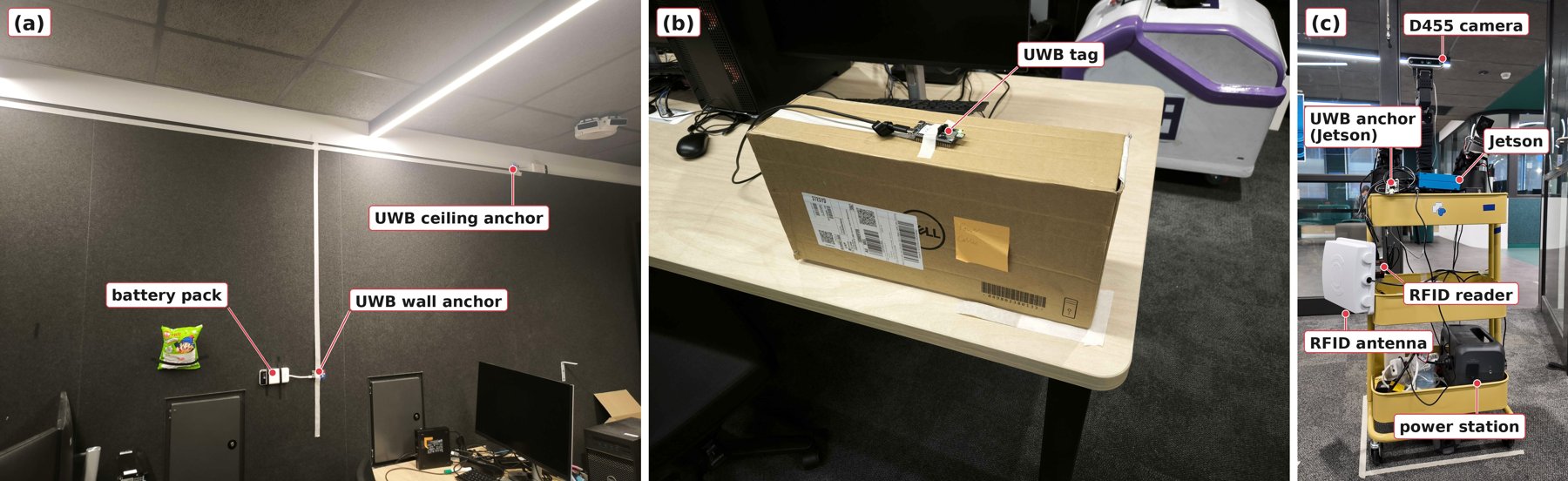
- Zone (RFID). A passive UHF reader on each hatch records which zone a container is in. The container needs no power for this.
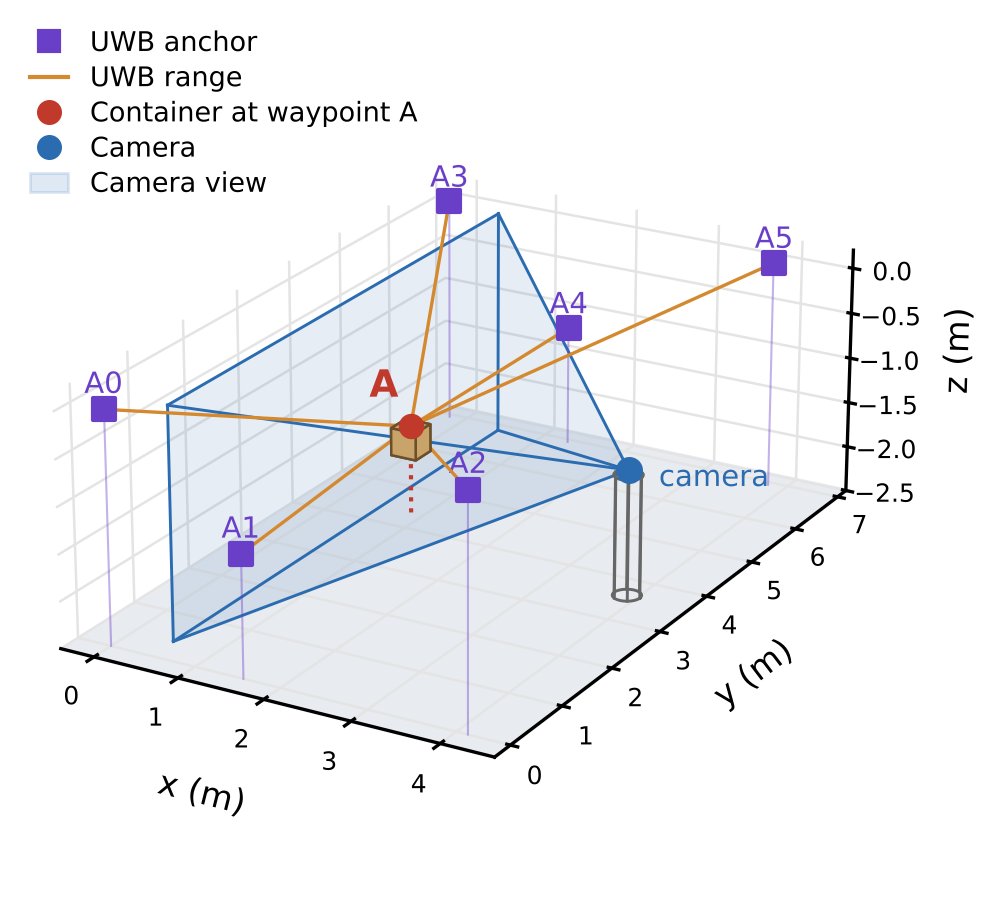
- Position (UWB). The container’s UWB tag ranges to that zone’s anchors. Per-anchor calibration removes antenna-delay bias, and an extended Kalman filter tracks position and velocity, updating on every range and rejecting outliers with an innovation gate.
- Refinement (camera). When a container is in view of the robot’s depth camera (Intel RealSense D455), YOLOE segments it, its depth gives a 3D position, and an OC-SORT-style tracker paired with the container (Hungarian matching) feeds that position into the EKF.
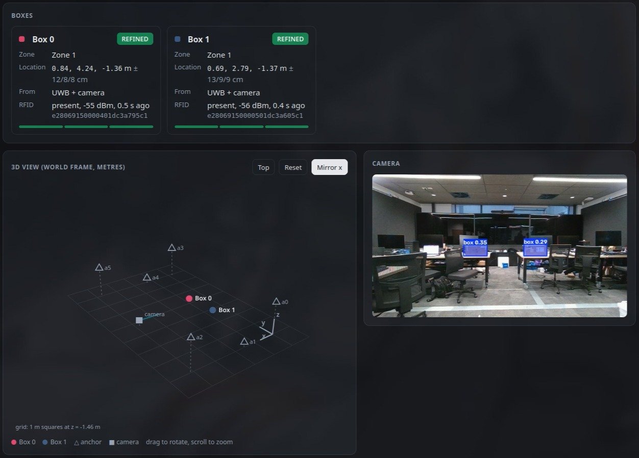
- Truth maintenance. An SQLite record holds every container’s expected position and contents (like a loading manifest). Each estimate is checked against it: agreement verifies it, and a contradiction is flagged as a mismatch.
Each container also carries a state that records which sensors currently support its estimate: detected (zone only), coarse (UWB), refined (UWB + camera) or coasting. That makes the reported position honest about how far it can be trusted.
Everything runs under ROS 2 on a Jetson Xavier NX, with the camera and reader carried on an XLeRobot mast.
Results
- RFID: tags were detected within 0.3–0.7 s at carry speeds up to about 3 m/s, but only within 0.2–0.3 m on the reader’s built-in antenna, so real hatches need an external antenna.
- UWB: per-anchor calibration cut static error from 68.0 cm to 15.4 cm (14.7 cm with weighting). The remaining bias drifts and depends on position, so anchors should be no more than about 3 m apart along a zone.
- Fusion: refined estimates had 15.7–19.3 cm error, against 22.9–37.4 cm for UWB alone, with 99–100% within 30 cm.
- Multiple containers: UWB tags kept two containers apart (13.7–19.1 cm at a surveyed point), but the camera tracker swapped identities where they crossed. In one run an ungated camera track pulled the estimate 3.6 m off, which shows camera association must be gated on the UWB identity.
- Embedded: median processing cycles took under 0.65 s on the Jetson.
Stack
ROS 2 · Python · UHF RFID (SparkFun M7E) · UWB (DW3000) · Intel RealSense D455 · YOLOE · EKF · SQLite · Jetson Xavier NX